Aeneas Wilder: exhibitions Association Pollen back«
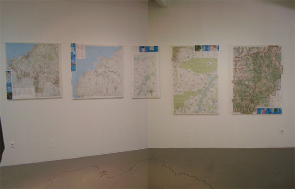
The Centre of France maps The exhibition space included the four main maps used to locate the co-ordinates for the four main land mass extremities of France. The maps showed clearly the geographic points taken. The centre of France was also shown, allowing the audience to follow the process involved in defining the geographical point for the centre of France and the subsequent work. |
|
|---|